District map 146 districts
Annex Table 2.2
Every farm the census enumerated
One dot per aquaculture farm. Published in the report as a map only — there is no table behind it, and it is finer than any figure on this site.
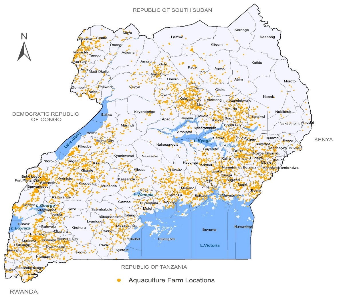
Map of Uganda with a dot at the location of each of the 9,463
                          aquaculture farms enumerated. Farms cluster densely around Lake
                          Kyoga, the Lango and Teso sub-regions, the shores of Lake Victoria
                          near Kampala, and the western districts around Kasese and Kabarole;
                          Karamoja in the north-east is almost empty.
Source: Uganda Aquaculture Census 2025 report